Portugal – key data
Area: 92,090 km² (of which land: 91,470 km², water: 620 km²). These values include the Azores and Madeira.
Population: 10.8 million (July 2011 estimate, CIA).
Population density: 116.5 residents per square kilometer
Population growth: 0.212% per year (2011, CIA)
Capital: Lisbon (564,657 residents)
Highest point: Ponta do Pico (Pico or Pico Alto) in the Azores, 2,351 m
Lowest point: Atlantic Ocean, 0 m
Form of government: Portugal has been a republic since 1910. The constitution dates from 1976, the last constitutional amendment was made in 1997. The Portuguese Parliament (Assembléia da República) consists of 230 members. Portugal became an independent kingdom in 1143, the personal union with Spain ceased to exist in 1640. Portugal has been a member of the European Union since 1986.
Administrative division: 18 districts (distrito, plural: distritos) u Aveiro, Beja, Braga, Braganca, Castelo Branco, Coimbra, Evora, Faro, Guarda, Leiria, Lisboa, Portalegre, Porto, Santarem, Setubal, Viana do Castelo, Vila Real as well Viseu
and 2 autonomous regions (regiao autonoma, plural: regioes autonomas): Acores and Madeira
Head of State: President Aníbal Cavaco Silva, since March 9, 2006
Head of Government: Prime Minister Pedro Passos Coelho, since June 21, 2011
Language: the official language in Portugal is Portuguese. Mirandes, a dialect belonging to Asturian, is also spoken in rural areas of Miranda do Douro. Mirandes is recognized as a minority language in Portugal.
Religion: Roman Catholic 84.5%, other Christians 2.2%, others 0.3%, unknown 9%, no religious affiliation 3.9% (2001 census).
Local time: Mainland: CET – 1 hour. Summer time (CET) is in effect in Portugal between the last Sunday in March and the last Sunday in October.
The time difference to Central Europe in both winter and summer -1 hour.
Azores: CET – 2 hours. Between the last Sunday in March and the last Sunday in October there is summer time in the Azores (CET – 1 hour).
The time difference to Central Europe in both winter and summer -2 hours.
Madeira: CET – 1 hour. Between the last Sunday in March and the last Sunday in October, Madeira has summer time (CET).
The time difference to Central Europe in both winter and summer -1 hour.
International phone code: +351
Internet identifier:.pt
Mains voltage: 230 V, 50 Hz
The Republic of Portugal is a state in southwestern Europe and occupies the west of the Iberian Peninsula as well as the Azores and Madeira. Portugal borders in the east and north on Spain and in the west and south forms the Atlantic ocean the natural limit. The total area of Portugal is 92,090 square kilometers. The Azores and Madeira together cover an area of 3,041 square kilometers.
Portugal’s share of the Iberian Peninsula is around one sixth; From a geological point of view, the country represents the south-western part of the so-called Iberian mass, a block of rock consisting of granite, gneiss, quartzite, limestone and slate. Portugal is traversed by a large number of rivers that carry water all year round, which have also been used for energy generation for some time. The two rivers Douro and Tejo, which have their source in Spain, divide the country into three major regions: northern, central and southern Portugal.
Northern Portugal extends between the Minho River, which forms the border with Spain in the north, and the Douro in the south. Several mountain ranges shape the landscape of this region, the highest mountains of which reach almost 2,000 meters. The strongly rugged mountain landscape and the Douro valley laid out in spacious terraces, where the world-famous port wine is grown, are the main tourist attractions of this region.
In central Portugal, the Serra da Estrela mountains dominate the appearance of this area. The ridge of the highest mountains in Portugal, which is strongly jagged by the strong western storms and the associated erosion, is also the only winter sports area in the country that deserves this name. This is where the Torre rises, the highest mountain on the Portuguese mainland at 1,993 meters. The Serra da Estrela runs to the southwest and merges into the low mountain range of the Estremadura, a climatically favorable and very fertile area. In the area of the Sado estuary and the Ribatejo, the landscape of central Portugal changes into fertile depressions and valleys with numerous thermal springs.
Southern Portugal consists predominantly of the Alentejo, an extensive, partly slightly wavy and partly completely flat plateau, which has isolated small mountains. The gigantic arable land, cork oak forests and olive trees are typical of this landscape. In the south, the fertile land is bounded by the Serra de Monchique mountain range, which protects the coastal landscape of the Algarve from the cold weather coming from the north.
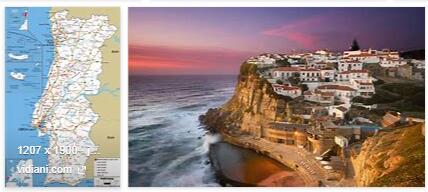
In the approximately 850-kilometer coast of Portugal, a distinction is the rock from the sandy Algarve. The rocky Algarve, famous for its steep cliffs and picturesque rock towers, has wide and flat sandy beaches in its countless bays. The sandy Algarve includes the estuaries of the Douro, Tejo and Guadiana.
Portugal climate
Portugal has a warm and sunny climate with mild winters. The summer temperatures in the Algarve reach more than 30 ° C, and it gets even hotter in the Alentejo and Alto Douro. In the north-west of Portugal the weather is milder and more humid. Here up to 2,000 mm of rain per year (the average in Portugal is 1,100 mm). Visit printerhall for Portugal Tour Plan.